A spring hike in the Val Gardena valley reveals the beauty of the “Saint Lake” and the Seceda Meadows
Image gallery: Hike to the Lech Sant lake and to Mt. Seceda


The starting point for our hike in the Val Gardena is the Cristauta-Praplan car park above Santa Cristina. The first section follows trail no. 4. We walk along the tarmac road for about 200 metres, then turn right onto a path leading up into the forest. We ignore the first junction and continue effortlessly, sometimes uphill and sometimes undulating. After crossing two small wooden fences, we reach another junction with signposts. We follow the path to the left towards the Lech Sant.
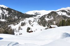
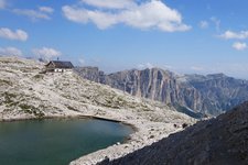
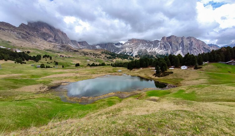
The wide forest track leads us out of the woods, and the view opens up to alpine meadows dotted with wooden huts. After an easy 40-minute ascent, we arrive at the Lech Sant and the eponymous hut, which is still closed. The Lech Sant is a lake and a protected natural monument at an altitude of 2,096 metres, and is the subject of a local legend. A chapel once stood where the lake is now, and shepherds would hold nightly festivities there. In doing so, they desecrated the ground.
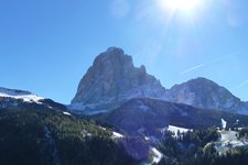
Suddenly, a large hole opened up, which filled with water and swallowed the chapel and the shepherds. It is said that sometimes the lights of the dancing shepherds can still be seen in its depths. The Malga Lech Sant, on the other hand, produces cheese and various dairy products and serves homemade dishes during the summer months. The view of the alpine pastures, Mt. Seceda, the Odle, and the surrounding peaks is majestic. After a short break, we continue on our way.
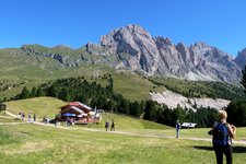
Keeping Mt. Seceda always in sight, we now face a steep and strenuous one-hour ascent, partly through meadows and partly following the signs. Clouds cover the peaks. The Seceda Meadows are a popular and therefore busy destination. This is due to the magnificent panorama of the Val Gardena Dolomites and the fact that Seceda can also be reached by cable car from Ortisei.
In May, at the time of our hike, the lifts are still closed. We therefore enjoy the tranquillity of this place and, enriched by memorable impressions, follow the same path back to our starting point.
Authors: Elena & Luca
Experienced: May 2020
Last update: 2025
-
- Starting point:
- Cristauta-Praplan car park (1,751 m a.s.l.), Santa Cristina
-
- Overall time:
- 04:30 h
-
- Total route length:
- 16,1 km
-
- Altitude:
- from 1.751 m to 2.519 m
-
- Altitude difference (uphill | downhill):
- +869 m | -869 m
-
- Signposts:
- 4, 1A, 1
-
- Destination:
- peak of Mt. Seceda (2,519 m a.s.l.)
-
- Resting points:
- Lech Sant Mountain Hut (mid-June to mid-September)
-
- Recommended time of year:
- Jan Feb Mar Apr May Jun Jul Aug Sep Oct Nov Dec
-
- Download GPX track:
- Hike to the Lech Sant lake and to Mt. Seceda
-
- More information:
- The overall time shown above refers to the walking time only, not including breaks.
If you want to undertake this hike, we recommend you to check the weather and trail conditions in advance and on site before setting out.