From the mountain station of the Col Raiser funicular to the summit of the Sass Rigais (3,025 m)
Image gallery: Via ferrata Sass Rigais
-
-
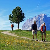
1277904651D-6454-Groeden-St-Christina-Col-Raiser-Sass-Rigais-WenigeSchrittevonderBergstationentferntkommtschonrichtigerAlmflairauf.jpg
-
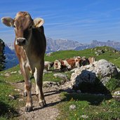
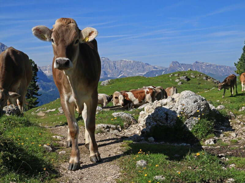
1277904664D-6483-Groeden-St-Christina-Col-Raiser-Sass-Rigais-AufdemFahrwegrundumderRegensburgerHuettekreuztmanweidendenKuehen.jpg
-
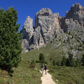
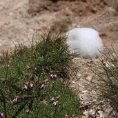
1277904675D-6502-Groeden-St-Christina-Col-Raiser-Sass-Rigais-ZwischendenwohltuendenLatschenkiefernkannmansichvordemKlettersteignocheinmalentspannen.jpg
-
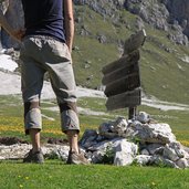
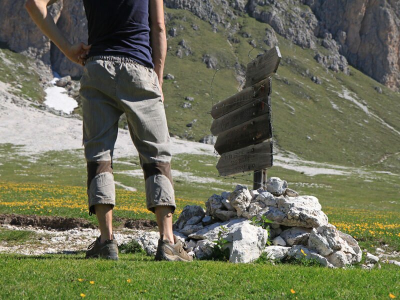
1277904688D-6526-Groeden-St-Christina-Col-Raiser-Sass-Rigais-DieKreuzungwosichderWegvielerWanderertrennt.jpg
-
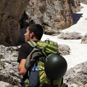
1277904700D-6557-Groeden-St-Christina-Col-Raiser-Sass-Rigais-JetztistSchlussmitLustig;derSteigbeginnt.jpg
-
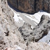
1277904713D-6560-Groeden-St-Christina-Col-Raiser-Sass-Rigais-SchonbaldbegegnetmandemerstenSchnee.jpg
-
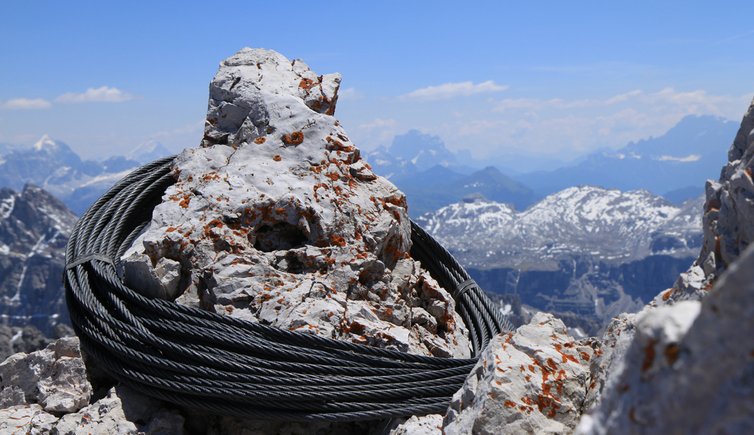
1277904730D-6592-Groeden-St-Christina-Col-Raiser-Sass-Rigais-TeilweisefehlendieStahlseile,desswegenistVorsichtgeboten.jpg
-
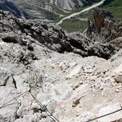
1277904746D-6594-Groeden-St-Christina-Col-Raiser-Sass-Rigais-EinhervorragenderAusblickaufsTal.jpg
-
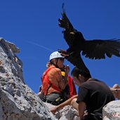
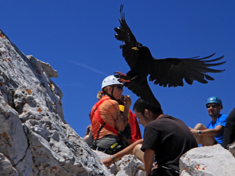
1277904766D-6622-Groeden-St-Christina-Col-Raiser-Sass-Rigais-DieRabenkreisenumdenGipfelumdieEssensrestederBergsteigerzuergattern.jpg
-
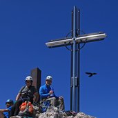
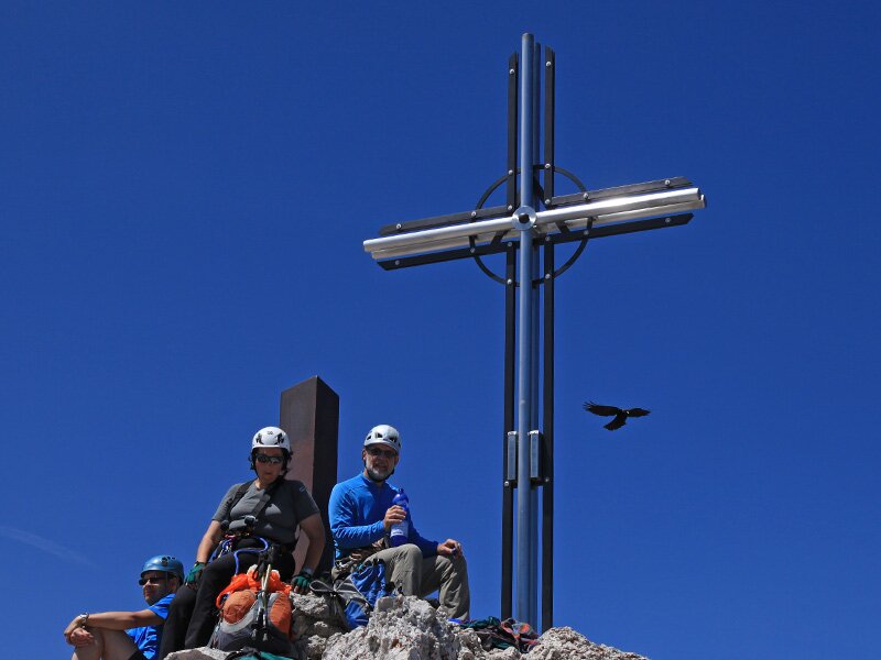
1277904779D-6626-Groeden-St-Christina-Col-Raiser-Sass-Rigais-AufdemGipfelsammelnsichdiewunschlosGluecklichen.jpg
-
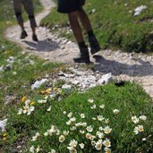
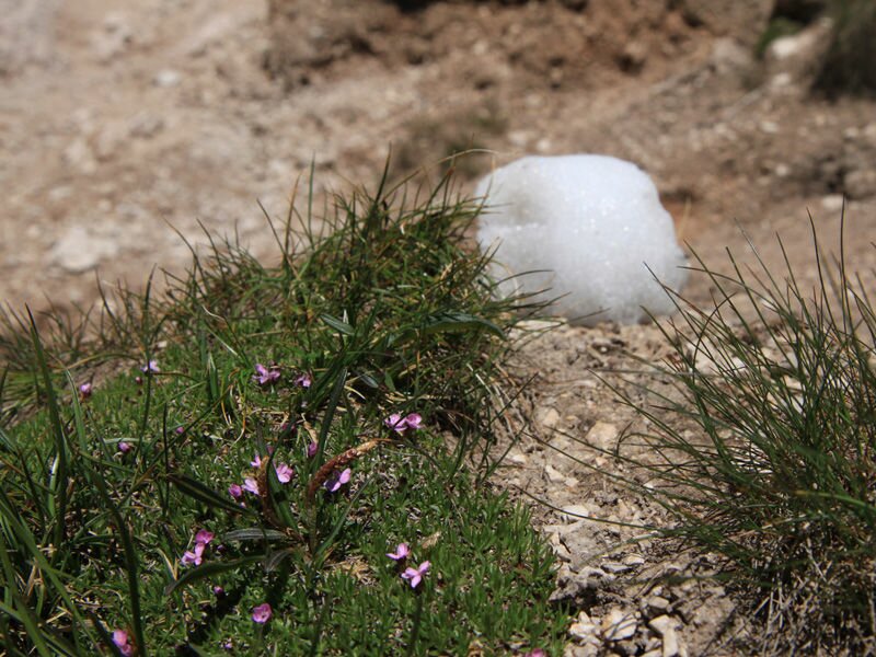
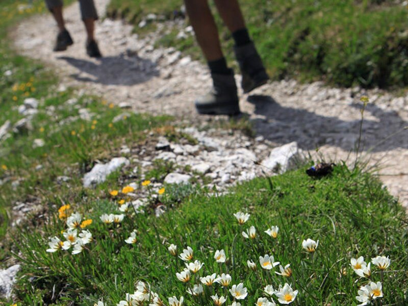
1277904794D-6709-Groeden-St-Christina-Col-Raiser-Sass-Rigais-ManfindeteineeinzigartigeBlumenlandschaftmitvielenFarbenundGeruechenvor.jpg
-
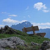
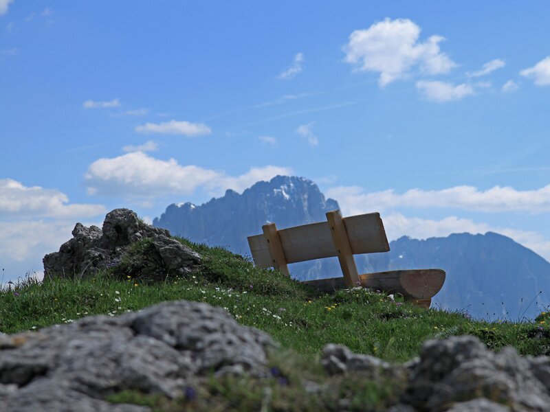
1277904805D-6711-Groeden-St-Christina-Col-Raiser-Sass-Rigais-AufdemHochplateaufindetmanidyllischeRastgelegenheitennochundnoecher.jpg
-
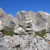
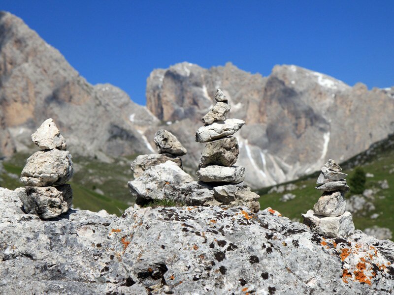
1277904817D-6729-Groeden-St-Christina-Col-Raiser-Sass-Rigais-DiemitLiebegebautenSteinpyramidenbietenauchtolleMotivefuerFotografen.jpg
-
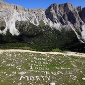
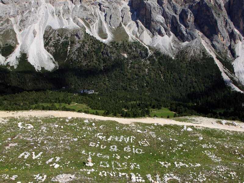
1277904829D-6732-Groeden-St-Christina-Col-Raiser-Sass-Rigais-DieWiesensindteilsrandvollmitNamen,SpruecheundZeichnungenausgelegt.jpg
-
video : Via Ferrata Brigata Tridentina


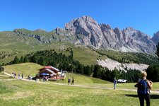
After a coffee in the Baita mountain hut, located directly near the funicular, we start our tour at 9 am. For about one hour we walk along a rather plain path towards north, we pass the Rif. Firenze and keep following the path number 13, a pleasure for all the senses.
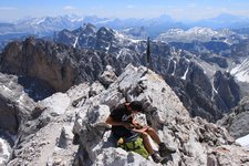
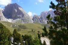
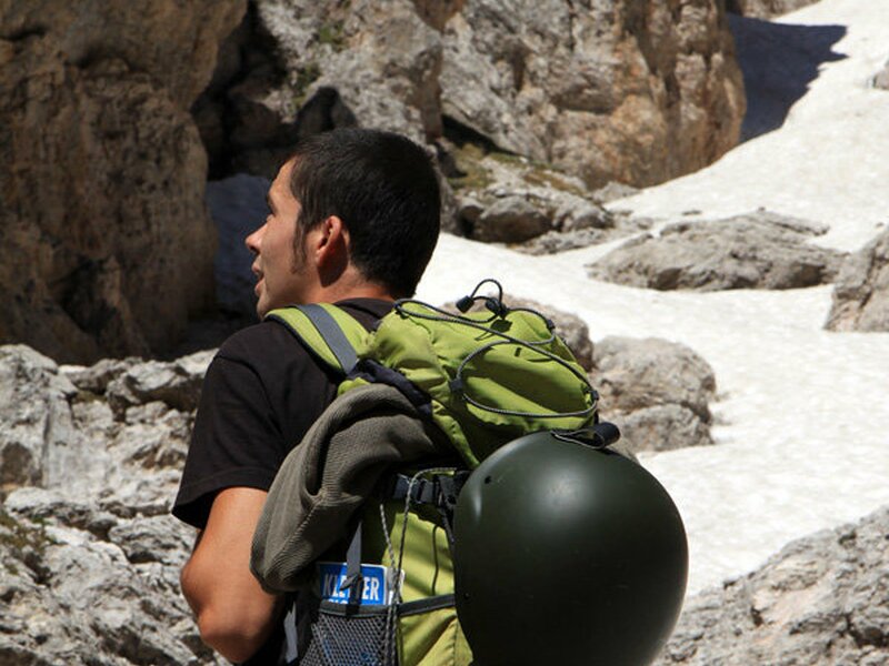
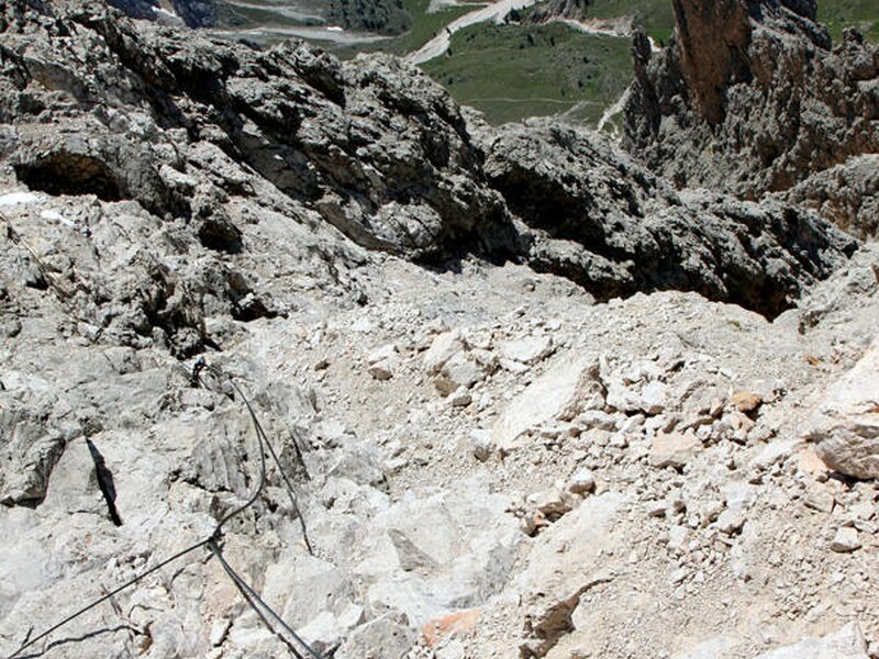
After about one hour we reach a crossing, where we decide to approach the mountain from the south, as in June there might still be snow on the northern side and the ropes might be snow-covered, too. From Plan Ciautier, there is a trail towards the Forcella Mesdì, snaking steeply up the mountain. The red signs on the wall on the right indicate the via ferrata. In the first part, the trail is rather steep, afterwards it gets easier and there are only few steel ropes. After another hour of walking (not climbing), the via ferrata starts, which is rather challenging. This fixed rope route (equipment required) leads us the way to the summit of the Sass Rigais and comes out to be a great route.
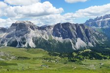
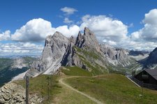
Once reached the top, we enjoy a breathtaking view on the Dolomites. Beside the main peak of the Odle mountain range, on which we stand right now, also the Furchetta (3,030 m) is particularly impressive. This pinnacle is famous for its north race of thousand metres.
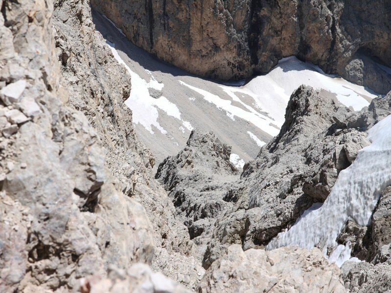
After a snack and an entry into the summit register, we take the east side of the mountain to climb down. As we just discover in the course of time, this side would have been better for the ascent. Due to the fact that the securing rope is in part snow-covered, we really have to take care where we put the next step. The trail snakes between Furchetta and Sass Rigais, which is really impressive. From that point you can cautiously slide down towards the valley on the snow.
Reached the crossing from the beginning of our walk, we take the same route back to the mountain station of the Col Raiser. Just in time, before 5 pm, we reach the funicular and take one of the last gondolas.
Author: EMS
-
- Starting point:
- Col Raiser mountain station
-
- Time required:
- 05:00 h
-
- Track length:
- 10,8 km
-
- Altitude:
- from 2.038 m to 3.020 m
-
- Altitude difference:
- +1052 m | -1052 m
-
- Route:
- Rif. Firenze alpine hut - Forcella Mezzodì - Sass Rigais - Forcella Salieries - Rif. Firenze alpine hut
-
- Signposts:
- 13
-
- Recommended time of year:
- Jan Feb Mar Apr May Jun Jul Aug Sep Oct Nov Dec
-
- Download GPX track:
- Via ferrata Sass Rigais
If you want to do this tour, we suggest you to check the weather and trail conditions in advance and on site before setting out.